Import NDFD Data from a File Containing GML Encoded Data
The Data Interoperability Extension allows users to import from files containing data encoded in Geography Markup Language (GML).
Since the NDFD XML Web Service can return NDFD data encoded in GML, users can save the results of a request to a file and then
import
the data into ArcMap. Two sample requests are provided below:
NDFD Data Encoded in GML for a Single Time
NDFD Data Encoded in GML for a Time Period
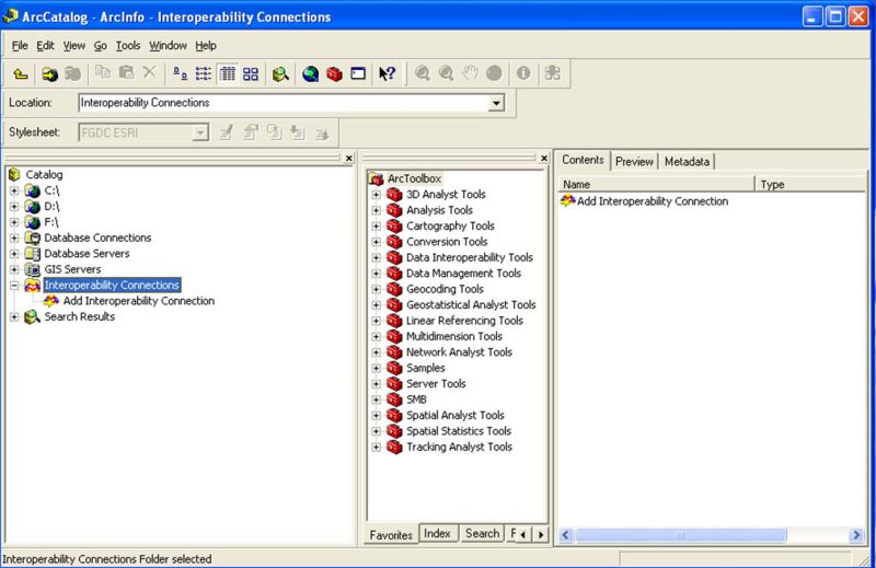
After starting ArcCatalog, click on the "Interoperability Connections" folder, and select "Add Interoperability Connection".
See the image below.
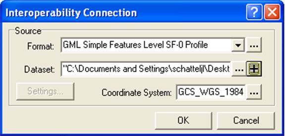
Select "GML Simple Feature Level SF-0 Profile" from the "Format" pull down menu of the "Interoperability Connection" window.
From the "Database" menu, locate and select the file containing the NDFD GML-encoded data. Then click "OK"
to dismiss the window See the image below.
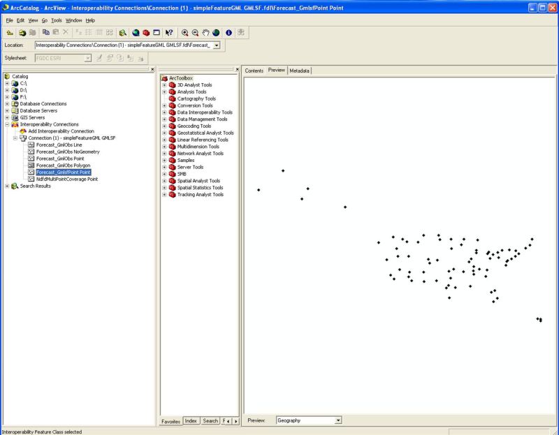
NOTE: The connection will have a number of feature types displayed (see image below). Use the
"Forecast_GmlsfPoint Point" feature.
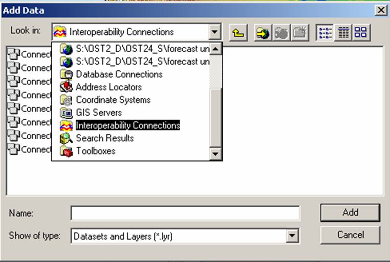
Now open ArcMap and click on the "Add Data" button. Then ensure the "Interoperability Connections" item is
selected from the "Look in" pull down menu. Select the connection that you created in the ArcCatalog. Click the
"Add" button to add the connection and dismiss the window. The points retrieved from the service should now be visible
on the map.
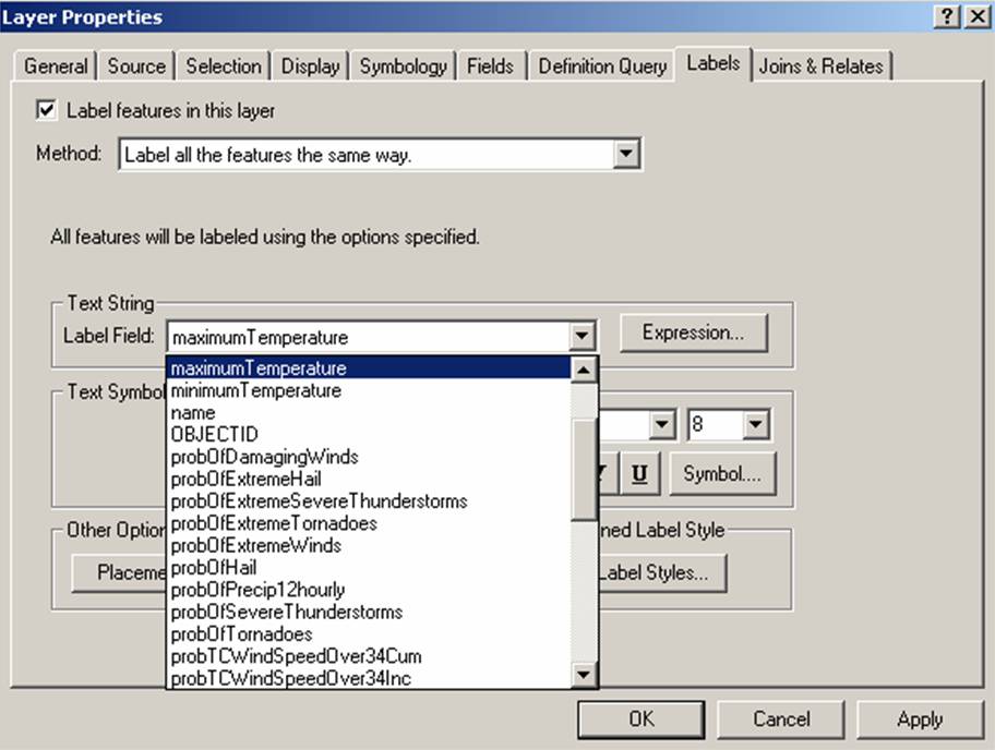
To display the NDFD elements, right click on the connection you just added and select the "Properties" menu item. In the
"Layer Property" menu, ensure the Label features in this layer check box is selected. Next select the NDFD element you
want displayed from the "Label Field" pull down menu. Click the "OK" button and the data for the selected
element should appear on the map.